Access to Data

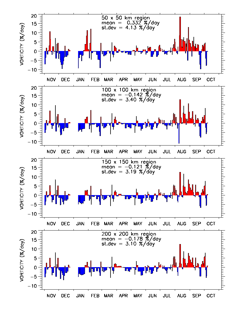
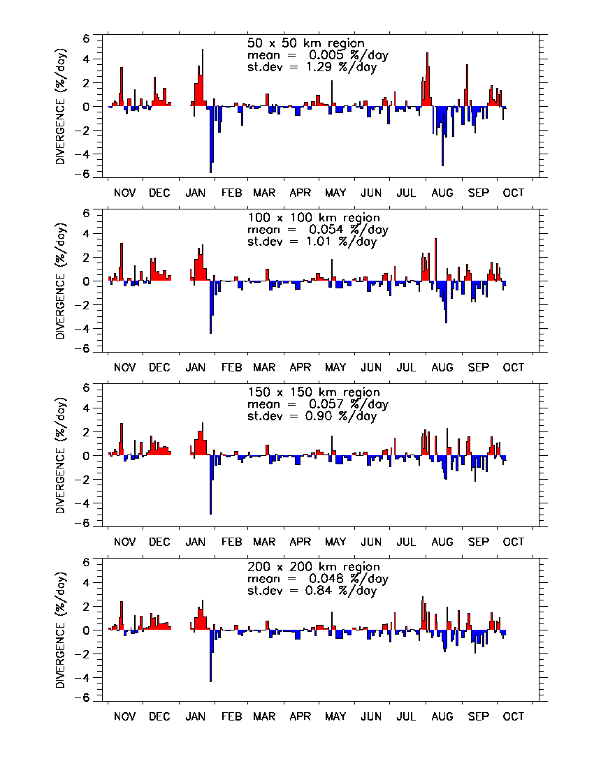
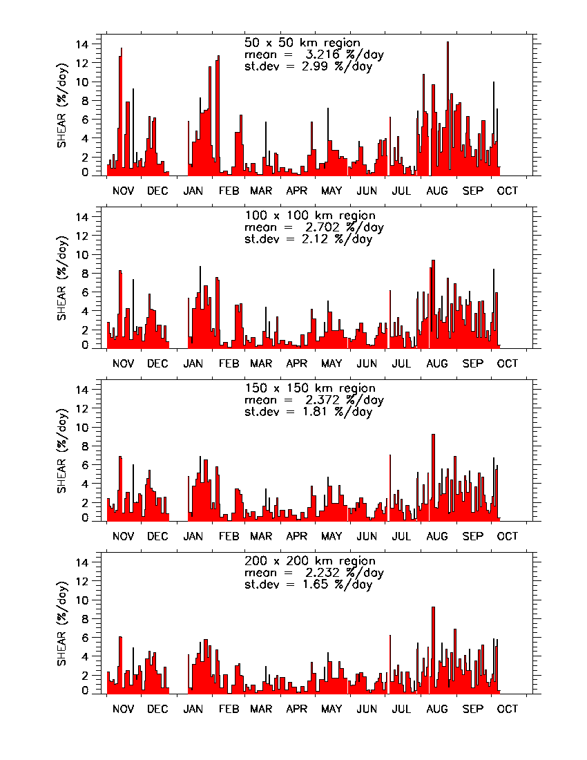
Below are plots of vorticity, divergence, and shear for the
four regions centered on the ship (50 x 50 km, 100 x 100 km,
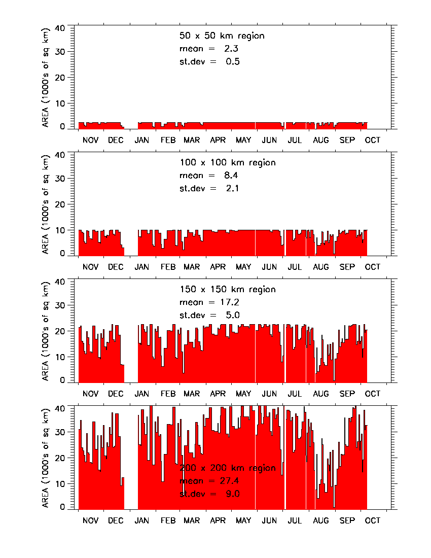
150 x 150 km, 200 x 200 km). Also, a plot of the actual AREA used in
each calculation is given below. For example, the area for the
calculation of deformation in each
100 x 100 km region should (ideally) be 10,000 sq km,
but if the ship happened to be near the edge of an image
then a corner of the 100 x 100 km box could be cut off,
and the actual area used in the calculation would be less than
10,000 sq km.
Here are the data files. They are ASCII text files, 736
lines long. After you select a file and it is displayed,
use your browser to save the file in text mode.
The file format is described below.
Here is the file format.
Please acknowledge the RADARSAT Geophysical
Processor System (RGPS) for computing the ice motion,
and the SHEBA Project Office for computing the ice deformation,
in any results or publications that use these data.