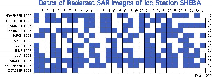
The blue squares indicate the days on which RADARSAT imaged the SHEBA region. There are no images before November 1, 1997, because RADARSAT was devoted to Antarctic imaging until that date. The SHEBA drift ended on October 11, 1998.
The right-most column gives the total number of images in each month. The grand total is 200 images for the period of the SHEBA drift. RADARSAT generally imaged the SHEBA region every 1 to 3 days. The longest data gap is from December 25 to January 10 (16 days).