Epibenthos Survey of the Bering Sea (B57)

Metadata also available as - [Questions & Answers] - [Parseable text] - [DIF]

Metadata:


Identification_Information:
Citation:
Citation_Information:
Originator: Grebmeier, J.M., L.W. Cooper, and M.L. Guarinello.
Originator:
Chesapeake Biological Laboratory, University of Maryland Center for Environmental Science
Publication_Date: 20100110
Title: Epibenthos Survey of the Bering Sea (B57)
Geospatial_Data_Presentation_Form: database
Series_Information:
Series_Name: Final Reports
Issue_Identification: B-57
Publication_Information:
Publication_Place: www.nprb.org
Publisher: North Pacific Research Board
Other_Citation_Details: Access database and Excel worksheet
Description:
Abstract:
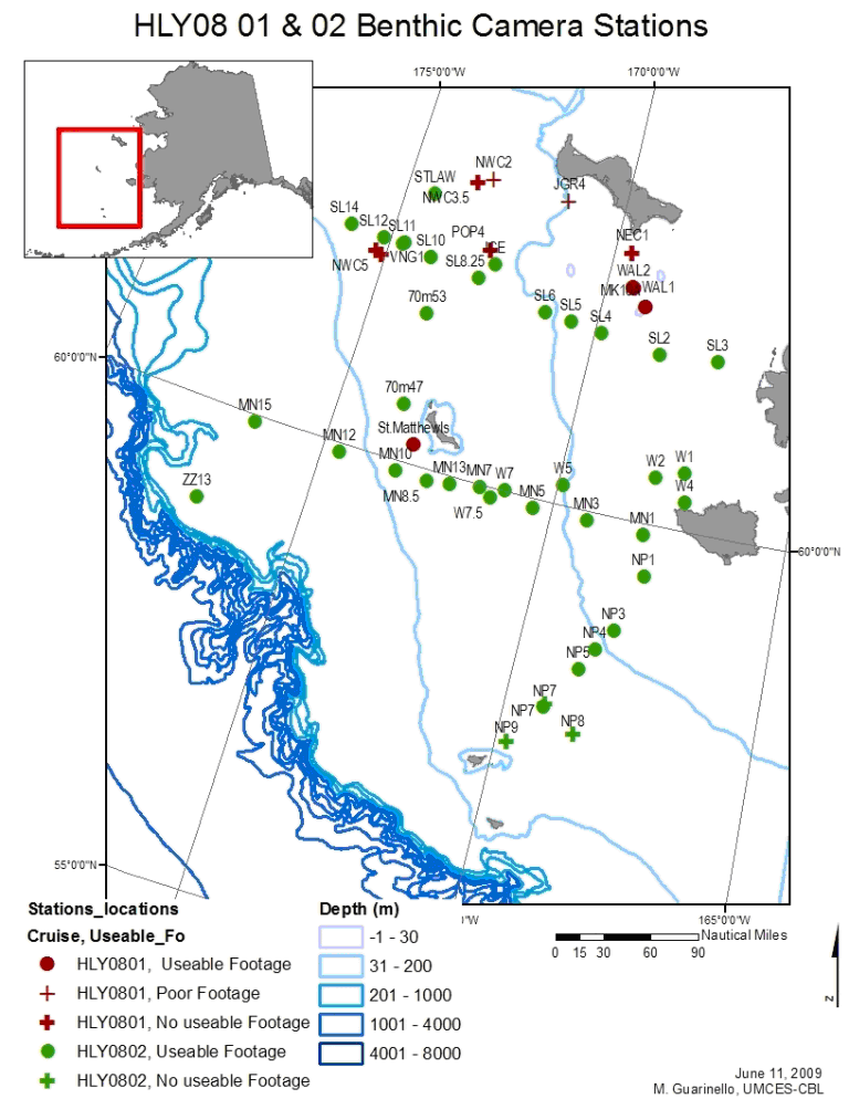
These data are part of a study detailed in Epibenthos Survey of the Bering Sea, NPRB Project B-57 Final Report.
The study area ranged from St Lawrence Island to south of St Matthew and Nuniavak Islands (north of 59N). Data were collected from March-May 2008.This Access database includes all summary data records from our analysis of underwater video including abiotic and biotic habitat descriptions, brittle and sea star abundance values, sediment topography values, and all non-video (i.e., grab sample) generated data. The database was also used in creating maps in ArcMap and associated GDB files are found in this file.
The Excel file includes results of all video analyses. Data not contained in the Access database includes details of identified fauna (GeneralDescrip worksheet) and counts (Counts Track worksheet) for each station from qualitative analysis, image still frame analysis results for 19 sites. Includes general descriptions of substrate, functional groups, classes/species that make up these groups, and additional features of note.
Purpose:
Our primary objective was to acquire and use underwater benthic video data for qualitative and quantitative epibenthic habitat characterization in the Bering Sea. The results also supplement traditional infaunal community data collections made during the two research cruises.
Time_Period_of_Content:
Time_Period_Information:
Range_of_Dates/Times:
Beginning_Date: 20080316
Ending_Date: 20080503
Currentness_Reference: observed
Status:
Progress: Complete
Maintenance_and_Update_Frequency: None planned
Spatial_Domain:
Description_of_Geographic_Extent:
Data encompasses the polynya area south of St. Lawerence Is. and areas west of St. Matthew Is. and between St. Matthew Is and Nunivak Is.
Bounding_Coordinates:
West_Bounding_Coordinate: -180.00000
East_Bounding_Coordinate: -165.00000
North_Bounding_Coordinate: 65.00000
South_Bounding_Coordinate: 55.00000
Keywords:
Theme:
Theme_Keyword_Thesaurus: IOOS Core Variables
Theme_Keyword: Version 1
Theme_Keyword: Fish Species
Theme_Keyword: Fish Abundance
Theme_Keyword: Bottom character
Theme:
Theme_Keyword_Thesaurus: None
Theme_Keyword: project_number:B57
Theme_Keyword: data_url:<http://data.eol.ucar.edu/codiac/dss/id=245.B57-001>
Theme_Keyword: archive_url:<http://www.eol.ucar.edu/projects/bsierp>
Theme:
Theme_Keyword_Thesaurus: None
Theme_Keyword: epibenthos
Theme_Keyword: underwater video
Theme_Keyword: habitat characterization
Theme_Keyword: Ophiura
Place:
Place_Keyword_Thesaurus: None
Place_Keyword: Bering Sea
Stratum:
Stratum_Keyword_Thesaurus: None
Stratum_Keyword: benthos
Temporal:
Temporal_Keyword_Thesaurus: None
Temporal_Keyword: 2008
Access_Constraints:
Access is restricted. Data policy: <http://www.eol.ucar.edu/projects/best/program_management_plan.pdf>
Use_Constraints:
Use is restricted. Data policy: <http://www.eol.ucar.edu/projects/best/program_management_plan.pdf>
Browse_Graphic:
Browse_Graphic_File_Name: Map_of_video_stations_HLY0801_HLY0802.png
Browse_Graphic_File_Description:
Figure 1. Map of video stations for HLY0801 and HLY0802 in the Bering Sea, 2008
Browse_Graphic_File_Type: PNG
Taxonomy:
Keywords/Taxon:
Taxonomic_Keyword_Thesaurus: None
Taxonomic_Keywords: invertebrates
General_Taxonomic_Coverage:
Only the most abundant fauna are noted here in taxonomy. Refer to the associated Excel file for other epifauna observed during our study.
Taxonomic_Classification:
Taxon_Rank_Name: Kingdom
Taxon_Rank_Value: Animalia
Taxonomic_Classification:
Taxon_Rank_Name: Phylum
Taxon_Rank_Value: Echinodermata
Taxonomic_Classification:
Taxon_Rank_Name: Class
Taxon_Rank_Value: Asteroidea
Applicable_Common_Name: Sea stars
Taxonomic_Classification:
Taxon_Rank_Name: Class
Taxon_Rank_Value: Ophiuroidea
Applicable_Common_Name: Brittle stars, basket stars
Taxonomic_Classification:
Taxon_Rank_Name: Order
Taxon_Rank_Value: Ophiurida
Taxonomic_Classification:
Taxon_Rank_Name: Family
Taxon_Rank_Value: Ophiuridae
Point_of_Contact:
Contact_Information:
Contact_Person_Primary:
Contact_Person: Jackie Grebmeier
Contact_Organization:
Chesapeake Biological Laboratory, University of Maryland Center for Environmental Scinece
Contact_Position: Research Professor
Contact_Address:
Address_Type: mailing and physical
Address: 1 Williams St.
Address: PO Box 38
City: Solomons
State_or_Province: MD
Postal_Code: 20688
Country: USA
Contact_Voice_Telephone: 1-410-326-7334
Contact_Electronic_Mail_Address: jgrebmei@cbl.umces.edu
Contact_Electronic_Mail_Address: cooper@cbl.umces.edu
Analytical_Tool:
Analytical_Tool_Description: PRIMER v6- used for multivariate data analysis and clustering
Tool_Access_Information:
Tool_Access_Instructions: Unspecified
Analytical_Tool:
Analytical_Tool_Description: iMovie used for editing video files
Tool_Access_Information:
Tool_Access_Instructions: Unspecified
Analytical_Tool:
Analytical_Tool_Description: Adobe Photoshop used for analyzing still frame images
Tool_Access_Information:
Tool_Access_Instructions: Unspecified

Data_Quality_Information:
Logical_Consistency_Report: Unspecified
Completeness_Report: Unspecified
Lineage:
Methodology:
Methodology_Type: Field
Methodology_Description:
We used a benthic camera system in 2008 to determine epibenthic community structure in the BEST-BSIERP study area (Figure 1) during cruises HLY0801 and HLY0802. The benthic camera system was a stand-alone system consisting of a surface-held video camera connected by electronic cable to a camera lens, lights, and laser pointers, all enclosed in a small metal cage, that allows independent deployment and fine control for real-time benthic imaging measurements.
Process_Step:
Process_Description:
We are analyzing the digital video imagery to determine epifaunal abundance and composition and compare these to epifaunal-size associated biomass data from previous trawling efforts to convert abundance and size from our camera survey to a rough estimate of biomass over a specific surface area.
Process_Date: Unknown
Process_Contact:
Contact_Information:
Contact_Person_Primary:
Contact_Person: Jackie Grebmeier
Contact_Organization:
University of Maryland Center for Environmental Science, Chesapeake Biological Laboratory
Contact_Address:
Address_Type: mailing and physical
Address: 1 Williams St.
Address: PO Box 38
City: Solomons
State_or_Province: MD
Postal_Code: 20688
Country: USA
Contact_Voice_Telephone: 410-423-7334
Contact_Electronic_Mail_Address: jgrebmei@cbl.umces.edu
Contact_Electronic_Mail_Address: cooper@cbl.umces.edu
Process_Step:
Process_Description:
New metadata record established for B57 Grebmeier. Prepared from orignial filename B57 Meta data video.doc and AMIS project information. Name: B57_Grebmeier_epibenthic.xml, renamed B57_Grebmeier.xml
Process_Date: 20091211
Process_Step:
Process_Description:
Metadata record EpibenthosB57.xml received by AOOS from PI, and combined with B57_Grebmeier.xml
Process_Date: 20100203

Spatial_Data_Organization_Information:
Direct_Spatial_Reference_Method: Point

Spatial_Reference_Information:
Horizontal_Coordinate_System_Definition:
Geographic:
Latitude_Resolution: 0
Longitude_Resolution: 0
Geographic_Coordinate_Units: Decimal degrees
Geodetic_Model:
Horizontal_Datum_Name: World Geodetic System of 1984
Ellipsoid_Name: World Geodetic System of 1984
Semi-major_Axis: 6378137
Denominator_of_Flattening_Ratio: 298.25722210088

Entity_and_Attribute_Information:
Overview_Description:
Entity_and_Attribute_Overview:
HLY0801.02_Video.xls:
Data sheets: Data_Stills analysis of still frames captured from video footage //Counts_Track counts of larger fauna, those not overly abundant,. Stills not as likely to represent abundance (e.g., spider crabs, starfish) //Gen_Descrip general habitat description from video notes (i.e., from watching video)
Entity_and_Attribute_Detail_Citation: see Final Report B-57
Overview_Description:
Entity_and_Attribute_Overview:
HLY080102_VIDEO.mdb:
Tables:
//All_Stations_Coord cruise; stationname_number; latitudeN, longitudeW
//Brittle_Sea_Stars cruise; station number, station name, stationname_number, n= sample size of still frame images, taxa=dominant at site, density=avg density of dominant fauna, substrate_dom= dominant sediment type from video observation, substrate_snd= secondary dominant sedimetn type, substrate_dom%, substrate_snd%, burrow density, burrow min diameter (threshold of 5 pixels), burrow max diameter, pit density, pit min diameter
//Cluster_Biotic cluster results from PRIMER Simprof test
//Descrip_PRIMER cruise, station name, station number, stationname_number, biotic_lumped=description of biotic habitat from video observation grouped into like categories; sediment= description of sediment type, PRIMER_Cluster=cluster groups from PRIMER Simprof test; JG_Cluster= clusters defined from PRIMER % similarity cut-offs determined by J Grebmeier
//Description Stationname_number, abiotic description from video analysis includes sediment and activity, biotic descriptions, functional_groups_ee= ecosystem engineer evidence (e.g., burrows suggesting bioturbation), paired burrows- presence/abense, functional groups= short hand of biotic
//Other Stills same column headings as Brittle_Sea_Star table w/o fauna designators
//Sediment cruise, station name, station number, stationname_number, sediment variables measured from grab samples collected at the same stations: grain size fraction in phi, modal sediment grain size, total organic carbon, total organic nitrogen, C/N ratio
//Shepard_grainsize cruise, station name, station number, stationname_number, grain size fraction in phi, sediments classified to Shepard system names
//Stations Stills analyzed (Yes, No), cruise, station name, station number, stationname_number, depth in meters, date in UTC, n=still frame images, useable footage (Yes, No)
//TopoBSStar microtopography features at sites where brittle star and sea star densities calculated. lat, long, station name, stationname_number, burrow density, pit density, abiotic description
Entity_and_Attribute_Detail_Citation: see Final Report B-57

Distribution_Information:
Distributor:
Contact_Information:
Contact_Organization_Primary:
Contact_Organization: National Center for Atmospheric Research
Contact_Person: Earth Observing Laboratory
Contact_Address:
Address_Type: mailing and physical
Address: 3450 Mitchell Lane
City: Boulder
State_or_Province: CO
Postal_Code: 80301
Country: USA
Contact_Voice_Telephone: 303-497-8154
Contact_Electronic_Mail_Address: codiac@ucar.edu
Contact_Electronic_Mail_Address: stott@ucar.edu
Distribution_Liability:
No warranty expressed or implied is made regarding the accuracy or utility of the data, nor shall the act of distribution constitute any such warranty. This disclaimer applies both to individual use of the data and aggregate use with other data. It is strongly recommended that careful attention be paid to the contents of the metadata file associated with the data. The NCAR and NPRB shall not be held liable for improper or incorrect use of the data described and/or contained herein.
Standard_Order_Process:
Digital_Form:
Digital_Transfer_Information:
Format_Name: XLS
File_Decompression_Technique: No compression applied
Digital_Transfer_Option:
Online_Option:
Computer_Contact_Information:
Network_Address:
Network_Resource_Name: <http://beringsea.eol.ucar.edu>
Digital_Form:
Digital_Transfer_Information:
Format_Name: ASCII
File_Decompression_Technique: No compression applied
Digital_Transfer_Option:
Online_Option:
Computer_Contact_Information:
Network_Address:
Network_Resource_Name: <http://beringsea.eol.ucar.edu>
Fees: None

Metadata_Reference_Information:
Metadata_Date: 20100128
Metadata_Contact:
Contact_Information:
Contact_Organization_Primary:
Contact_Organization: National Center for Atmospheric Research
Contact_Person: Earth Observing Laboratory
Contact_Address:
Address_Type: mailing and physical
Address: 3450 Mitchell Lane
City: Boulder
State_or_Province: CO
Postal_Code: 80301
Country: USA
Contact_Voice_Telephone: 303-497-8154
Contact_Electronic_Mail_Address: codiac@ucar.edu
Contact_Electronic_Mail_Address: stott@ucar.edu
Metadata_Standard_Name:
FGDC Biological Data Profile of the Content Standard for Digital Geospatial Metadata
Metadata_Standard_Version: FGDC-STD-001.1-1999
Metadata_Access_Constraints: None
Metadata_Use_Constraints: None
Metadata_Security_Information:
Metadata_Security_Classification_System: None
Metadata_Security_Classification: Unclassified
Metadata_Security_Handling_Description: None

This page is <http://www.eol.ucar.edu/projects/bsierp/docs/B57_Grebmeier.html>
Generated by mp version 2.9.23 on Tue Mar 25 15:00:20 2014