


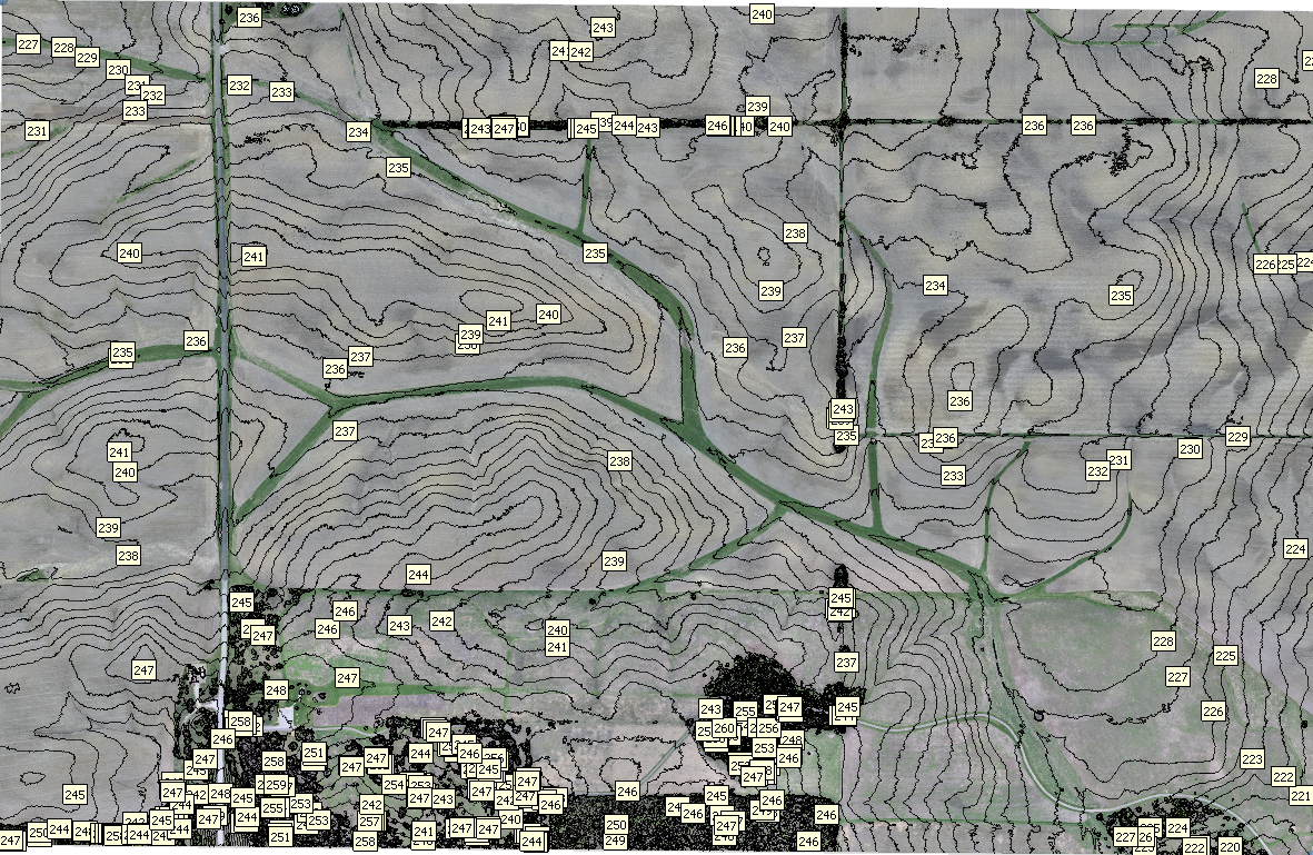
SAVANT Field Site Orthophoto and High Resolution DEM
Summary
A fixed wing unmanned aerial system (UAS) was used to obtain a dense array of overlapping images of the SAVANT field site, from which a high-resolution, geographically registered digital elevation model (DEM) and orthophoto were derived photogrammetrically. The survey flight was conducted on April 24, 2019 at a time when there was no crop cover, thus derived elevations correspond to actual topography except in heavily wooded areas.
Data access
- ORDER data for delivery by FTP
Additional information
| Identifier | |
| Data Quality | final |
| Versions |
|
| Subscribe | Subscribe to receive email when new or updated data is available. |
| Related projects | |
| Frequency | continuous |
| Language | English |
| Categories | |
| Platforms | |
| Instruments | |
| GCMD Science Keywords | Expand keywords |
| Documentation |
|
| Related links |
|
Temporal coverage
| Begin datetime | 2018-08-01 00:00:00 |
| End datetime | 2019-04-25 00:00:00 |
Spatial coverage
Map data from IBCSO, IBCAO, and Global Topography.
Maximum (North) Latitude:
40.21614,
Minimum (South) Latitude:
40.20627
Minimum (West) Longitude:
-88.416,
Maximum (East) Longitude:
-88.39609
Primary point of contact information
EOL Data Support <datahelp@eol.ucar.edu>
Additional contact information
- author: Grant W. Petty
Citation
Petty, G. 2019. SAVANT Field Site Orthophoto and High Resolution DEM. Version 1.0. UCAR/NCAR - Earth Observing Laboratory. https://doi.org/10.26023/9X98-348Q-V14. Accessed 27 Jul 2024.
Today's date is shown: please replace with the date of your most recent access.