


Satellite-derived polynya areas in the northern Bering Sea
Summary
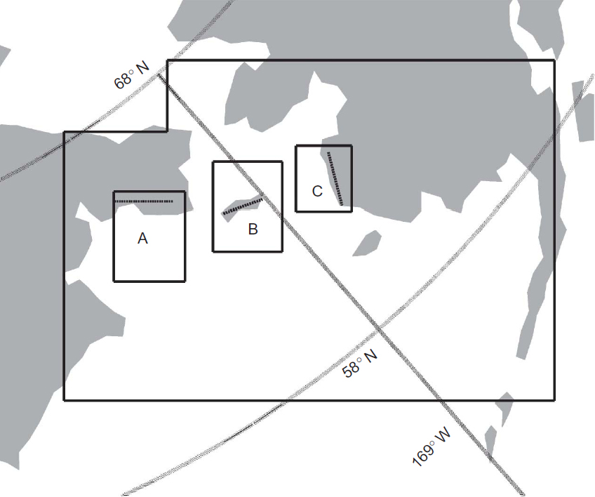
Satellite-derived Advanced Microwave Scanning Radiometer - EOS (AMSR-E) sea ice concentrations are utilized to calculate polynya areas in the northern Bering Sea (January-April from 2003 to 2008). Three polynya regions are presented: (a) Anadyr Gulf Polynya; (b) St. Lawrence Island Polynya; and (c) Cape Romanzo Polynya. Data are in Excel (.xls) and comma delimited (.csv) format. Data were collected during the Bering Sea Ecosystem Study-Bering Sea Integrated Ecosystem Research Program (BEST-BSIERP). BEST-BSIERP together are the Bering Sea project.
Data access
- ORDER data for delivery by FTP
Additional information
| Identifier | |
| Versions |
|
| Subscribe | Subscribe to receive email when new or updated data is available. |
| Related projects | |
| Spatial Type | multiple |
| Frequency | daily |
| Language | English |
| ISO Topic Categories |
|
| Categories | |
| Platforms | |
| Instruments | |
| Sites | |
| GCMD Science Keywords | Expand keywords |
| Documentation |
|
| Related links |
|
Temporal coverage
| Begin datetime | 2003-01-01 00:00:00 |
| End datetime | 2008-04-30 23:59:59 |
Spatial coverage
Map data from IBCSO, IBCAO, and Global Topography.
Maximum (North) Latitude:
66.50,
Minimum (South) Latitude:
58.00
Minimum (West) Longitude:
-175.00,
Maximum (East) Longitude:
-160.00
Primary point of contact information
Karen E. Frey <kfrey@clarku.edu>
Additional contact information
- author: Hongli Fu
- author: Jinping Zhao <jpzhao@ouc.edu.cn>
- author: Karen E. Frey <kfrey@clarku.edu>
- originator: Karen E. Frey <kfrey@clarku.edu>
Citation
Fu, H., et al. 2011. Satellite-derived polynya areas in the northern Bering Sea. Version 1.0. UCAR/NCAR - Earth Observing Laboratory. https://doi.org/10.5065/D6K935JP. Accessed 27 Jul 2024.
Today's date is shown: please replace with the date of your most recent access.